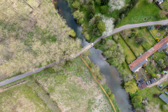
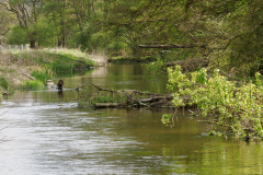
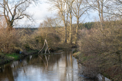
These groups of images are of sites on the Little Ouse where navigational structures and river crossings stood, or still stand. The sites are in order, proceeding upstream towards the Little Ouse’s source.
Crosswater Stanch
Grid ref. TL
Coordinates N E
NHER Record
There is some debate about when Crosswater Stanch was built. Some believe it probably originated in the immediate post-Denver Sluice period and was constructed to allow navigation to continue to Brandon, if not to Thetford. Others hold that it was the last stanch built, in 1751.
The remains of Crosswater Stanch can be seen from the path along the south bank of the Little Ouse. Note the large cap stones to the piers and the round pintle housings that show at least this stanch had mitre gates at some stage.
Green Dragon Inn
Grid ref. TL
Coordinates N E
NHER Record
There are some remains just east of the same footpath as passes Crosswater Stanch. They appear to be large sections of cast-in-situ concrete foundations, some in what may be original positions, others dislodged. The whole site is very overgrown
Sheepwash Stanch
The original location can be viewed from the path on the north bank of the river but there are no visible remains. A substantial amount of brickwork and masonry remains of the later stanch are present on the south bank, and can be viewed from the path along the river on the north bank.
This document from Andy Carter discusses the historical locations of Sheepwash Stanch.
Brandon Stanch (early)
A mass of masonry rubble buried within the south bank suggests the location of the earlier Brandon Stanch. These remains can be seen from the path on the north bank in favourable conditions.
Brandon Stanch (late)
No visible traces remain of the earlier construction.
Brandon Bridge
Santon Downham Road Bridge
There have been many claims that the Belfast truss bridge at Santon Downham was erected early in WWI by the Canadian Forestry Corps who were felling and milling timber as part of the war effort. In fact the Canadians didn’t arrive in Santon Downham until 1918-19. The bridge seems to date from the late 1880s.
St. Helen’s Picnic Site – Footbridge
Beneath the present wooden footbridge, in mid-stream, are the remains of four large posts arranged in a square. These are believed to be supports for a vehicular bridge built when Santon Downham was isolated and occupied by the military during WW2. The concrete road on the south side of the river is still known as the ‘military road’.
Santon Downham Stanch
Some brickwork remains on the south bank, with possibly some further remains to the north bank. All traces of the islands have been removed. This stanch had a keeper and keeper’s cottage but there are no obvious remains of these, just possible impressions/footprint of a building visible in some conditions.
Croxton Stanch
Grid ref. TL 8469 8701
Coordinates N52.44986 E0.71908
NHER Record
There are remains of original brickwork and masonry on the south bank. The north bank, from where the modern steel footbridge springs, is supported by sandbags with little evidence of the original structure.
Jon Wilson-Bright visited the site in September 2019, when the water levels in the Little Ouse were exceptionally low. The stone bank structure of the former stanch was more visible than normal, as were some remnants exposed on the river bed.
Later pics by Andy Carter
Turfpool Stanch
There are reports of some remains to both banks, both masonry and brickwork, but our volunteers were not able to visit this site.
Thetford Middle Stanch
This was completely obliterated in 1961 by the erection of Abbey Heath Gauging Station and a concrete footbridge. Middle Stanch was so named because it was built on an island in the middle of the river.
Thetford No. 1 Stanch
Thetford Stanch was demolished 1932 by Royal Engineers. It was replaced by Thetford No. 1 Sluice, with two steel sluice gates and a fish ladder to the south side. The north bank appears to be in concrete though the south bank has a large portion in brick, best viewed from the north bank. Could this be remains of the original stanch?


